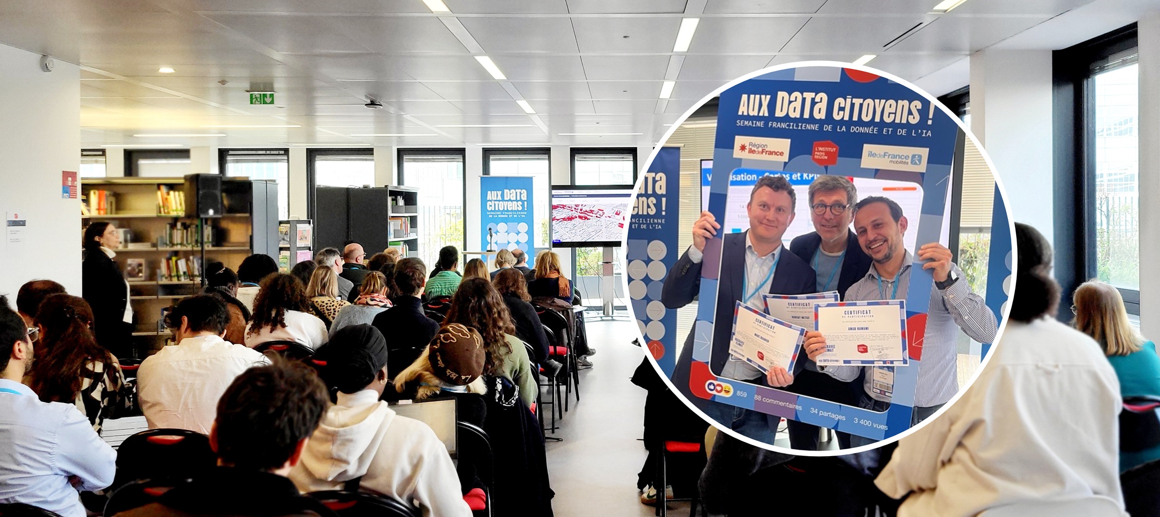
How can citizens and decision-makers be better informed about the risks of climate change and the vulnerability of transport infrastructure? The answer lies in one word: data visualisation. In response to this challenge, SYSTRA took part in the Hackaviz Climat, an event organised by the Île-de-France Region and Île-de-France Mobilités to coincide with the Paris region data week.
Out of 15 entries, SYSTRA won 2nd prize for its ClimateViz solution. Only available in French for the moment, this data visualisation application was designed in a record time of three weeks by a team of five experts from SYSTRA SA and SYSTRA France. It can be used to identify the vulnerabilities of an infrastructure to climatic hazards. The hackathon case study concerned the Paris region rail network and its vulnerability to flooding (of the Seine) and forest fires.

This hackathon was a great collaborative experience. The case study enabled us to demonstrate all our skills and our ability to support our clients in transport infrastructure vulnerability studies. Together we were able to create this promising application based on anticipating future climate conditions, going beyond historical data.
Marc Boudier, Decarbonisation and Climate Change Lead, Sustainability Department, SYSTRA SA
ClimateViz: the ingredients of a winning application
ClimateViz will eventually complement our range of services and solutions. The application enables the vulnerabilities of infrastructures or networks to be visualised under current and future conditions, i.e. geographical areas where exposure to a climate hazard and sensitive assets intersect.
Developed in-house using ArcGis technology, ClimateViz is a mapping application that enables you to:
- Display the vulnerabilities of a transport infrastructure in fine detail (100m x 100m grid) on maps;
- Anticipate the evolution of this vulnerability in the face of future climate conditions, taking into account historical data and going beyond it using reference data from climate projection models;
- Identify vulnerable assets that could benefit from adaptation measures.
ClimateViz tested on the Paris region rail network
During the hackathon, ClimateViz was tested on the Paris region rail network, in the face of flooding on the Seine and forest fires. The methodology used can be replicated for other linear transport infrastructures, other climatic hazards and other geographical areas. This is a major advantage for decision-makers, given that transport infrastructure maintenance costs could increase 20-fold in Europe by 2080 as a result of climate change, at the current rate of greenhouse gas emissions (source: IPCC).


 Australia
  Brazil
  Canada
  Chile
Chile  China
China  Columbia
  Denmark
  Egypt
Egypt  France
  India
India  Indonesia
  Ireland
  Italy
Italy  Malaysia
  New Zealand
  Norway
  Panama
  Peru
Peru  Poland
  Portugal
  Saudi Arabia
  Singapore
  South Korea
  Spain
Spain  Sweden
  Taiwan
  Thailand
  Türkiye
  United Kingdom
  United States
  Vietnam


