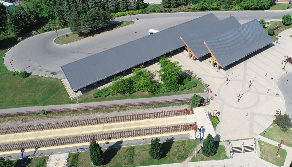
SYSTRA Canada used its expertise in drones to get a bird’s eye view of the project.
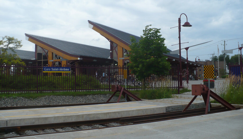
How do you adopt a different point of view on the accessibility improvements to be made to an infrastructure? To better advise our client, the operator exo, SYSTRA Canada’s teams used a drone flight over Saint-Jérôme station. This enabled more data to be aggregated than in a conventional feasibility study, making suggestions for the installation of equipment and new services for users more robust.


From a cloud of points to a complete overview
To carry out the survey, you first need to identify control points and record their geolocation coordinates using GPS. The survey can then begin, using 360° panoramic cameras to photograph the areas and draw up a high-resolution topographical map. All the elements that make up accessibility are inventoried: parking spaces, pavements, pathways, and access to buildings.
The images are then processed by photogrammetry1 software, which matches the images with points to determine the shape, dimensions, and spatial location of the buildings. The formalized data display is accessible to the teams in real time. Once processed, the data can be used by other solutions, for example to optimize parking spaces using artificial intelligence.


Drones can make a number of valuable contributions: they can be used quickly, with results available within 48 hours; they provide elevation data to give a better understanding of the topography of pedestrian walkways; and they give clients a completely up-to-date view of their building, in the form of a 2D map. We took the immersive experience a step further, offering a 360° virtual tour of the buildings and their surroundings. The client immediately saw the value of these tools for their projects and their contacts!
Stephan Krajicek, Team leader, mechanical projects – SYSTRA Canada
Towards an immersive visit
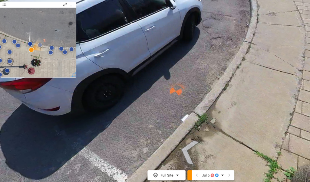
In addition to the static survey and the digital surface and elevation models, the drones offer the possibility of immersive visits: the team used the CUPIX Works SaaS (Software as a Service) platform and the DroneDeploy solution to transform the 360° shots taken by the drones into data that can be used for a virtual 3-D fly-through, similar to Google Streetview. This enables project participants to navigate the project site as if they were there, and to make decisions more efficiently.
Moreover, the interactive dimension of the experience is another asset for the life of the project, since the CUPIX platform provides tools for measuring distances, surfaces, and volumes. All this means that both the client and our teams can annotate, collaborate, and share information directly on the platform, which becomes the working environment for discussing studies and, ultimately, monitoring worksites.
Thanks to this reference, SYSTRA can now position itself, when tenders are invited, as an expert in the use of drones and technologies that capture the reality on the ground, whether for project design or construction supervision.
Key features – Drone inspection of Saint-Jérôme station
- 3 overflights
- 6 hours of inspection
- 45 minutes of 360° video captured
- 2 employees: 1 pilot operator and 1 observer
- Data processed and delivered to the client within 48 hours
- Photogrammetry is a measurement technique that consists in determining the shape, dimensions and location of an object in space by taking several photographs of it. ↩︎
 Australia
  Brazil
  China
China  Denmark
  France
  India
India  Indonesia
  Ireland
  Italy
Italy  Malaysia
  New Zealand
  Norway
  Poland
  Saudi Arabia
  Singapore
  South Korea
  Sweden
  Thailand
  United Kingdom
  United States
  Taiwan
  Vietnam