
 Australia
  Brazil
  Canada
  Chile
Chile  China
China  Columbia
  Denmark
  Egypt
Egypt  France
  India
India  Indonesia
  Italy
Italy  Malaysia
  New Zealand
  Norway
  Panama
  Peru
Peru  Poland
  Portugal
  Saudi Arabia
  Singapore
  South Korea
  Spain
Spain  Sweden
  Taiwan
  Thailand
  Türkiye
  United Kingdom
  United States
  Vietnam
 A NEED FOR ECONOMIC EVIDENCE
Solent Transport needed an evidence-based land-use transport interaction (LUTI) model to understand and forecast travel demand and behaviour of key travel modes in South Hampshire including road traffic, bus, rail, ferries and active modes.
The model was required to test land-use and transport policies and strategies and tests individual scheme interventions to provide transport economic evidence for Business Case development.
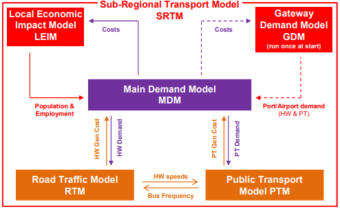
cREATING A Sub Regional Transport Model
SYSTRA was commissioned to support the development and application of Solent Transport’s Sub Regional Transport Model (SRTM). The TAG compliant, Land Use Transport Interaction (LUTI) model represents the travel demand and behaviour of key travel modes in South Hampshire (road traffic, bus, rail, ferries and active modes).
The model also contains processes to examine travel demand at the region’s key international gateways – the primary seaports at Southampton and Portsmouth, and Southampton Airport. The model was updated by SYSTRA in 2016-17 and 2021-22 to refresh the underlying traffic survey and land use data.
The model consists of five main elements including the Local Economic Impact Model:
- Road Traffic Model built in SATURN
- Public Transport Model built in CUBE Voyager
- Local Economic Impact Model (LEIM) built using the DELTA land-use modelling package
- Gateway Demand Model to represent port and airport demand built using CUBE
- Main Demand Model built in SYSTRA’s demand model software using C# and SQL databases
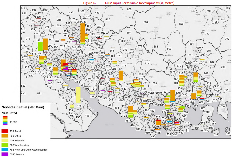
For each zone of the modelled area, the Local Economic Impact Model (LEIM) forecasts:
- detailed demographic characteristics including the number of households and population by person type;
- detailed economic characteristics including the number of jobs, by sector and socio-economic level;
- the amount of residential and commercial floor space as well as vacancy rates and prices;
- the uptake of planning permissions by use class
The model forecasts each year of the forecast period (2020 with 2041), and both local and model wide results are influenced by a range of factors, including, importantly, the performance of the transport network and the impact that has on accessibilities. The changes in the supply of housing and employment floorspace are controlled in line with local planning policies when and where appropriate as well as being varied to test individual development schemes.
The model’s overall demographic and economic growth can be allowed to vary, to test the impact of transport and planning policies, or fixed to test the consequences of higher or lower growth and understand within model displacement. The outputs of the LEIM are used by the transport models to predict the demand for travel to and from areas within South Hampshire and they can be compared to assess the land-use/economic impacts of different planning and transport policies.
Predicting Travel Demands
The Local Economic Impact Model (LEIM) forms part of Solent Transport’s Sub-Regional Transport Model, an evidence-based land-use and transport interaction model which provides a strong analytical basis for the development of coherent, objective-led implementation plans to bring the change in provision required to deliver prosperity to the area.
The model has been used for projects including Portsmouth and Southampton Transforming Cities Fund bids and Waterside Rail Restoring Your Railway fund business case.