

 Australia
  Brazil
  Canada
  Chile
Chile  China
China  Columbia
  Denmark
  Egypt
Egypt  France
  Indonesia
  Ireland
  Italy
Italy  Malaysia
  New Zealand
  Norway
  Panama
  Peru
Peru  Poland
  Portugal
  Saudi Arabia
  Singapore
  South Korea
  Spain
Spain  Sweden
  Taiwan
  Thailand
  Türkiye
  United Kingdom
  United States
  Vietnam
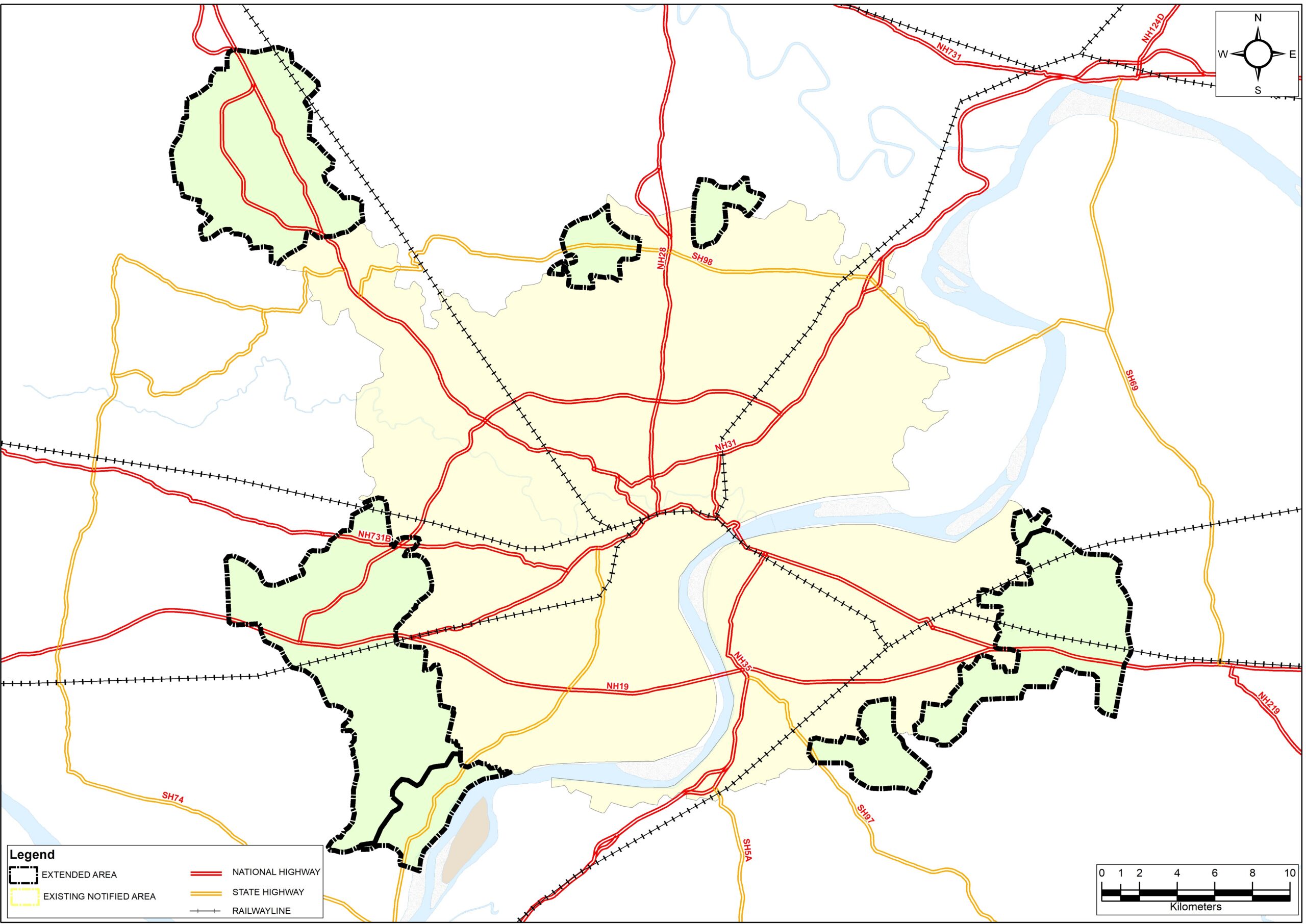
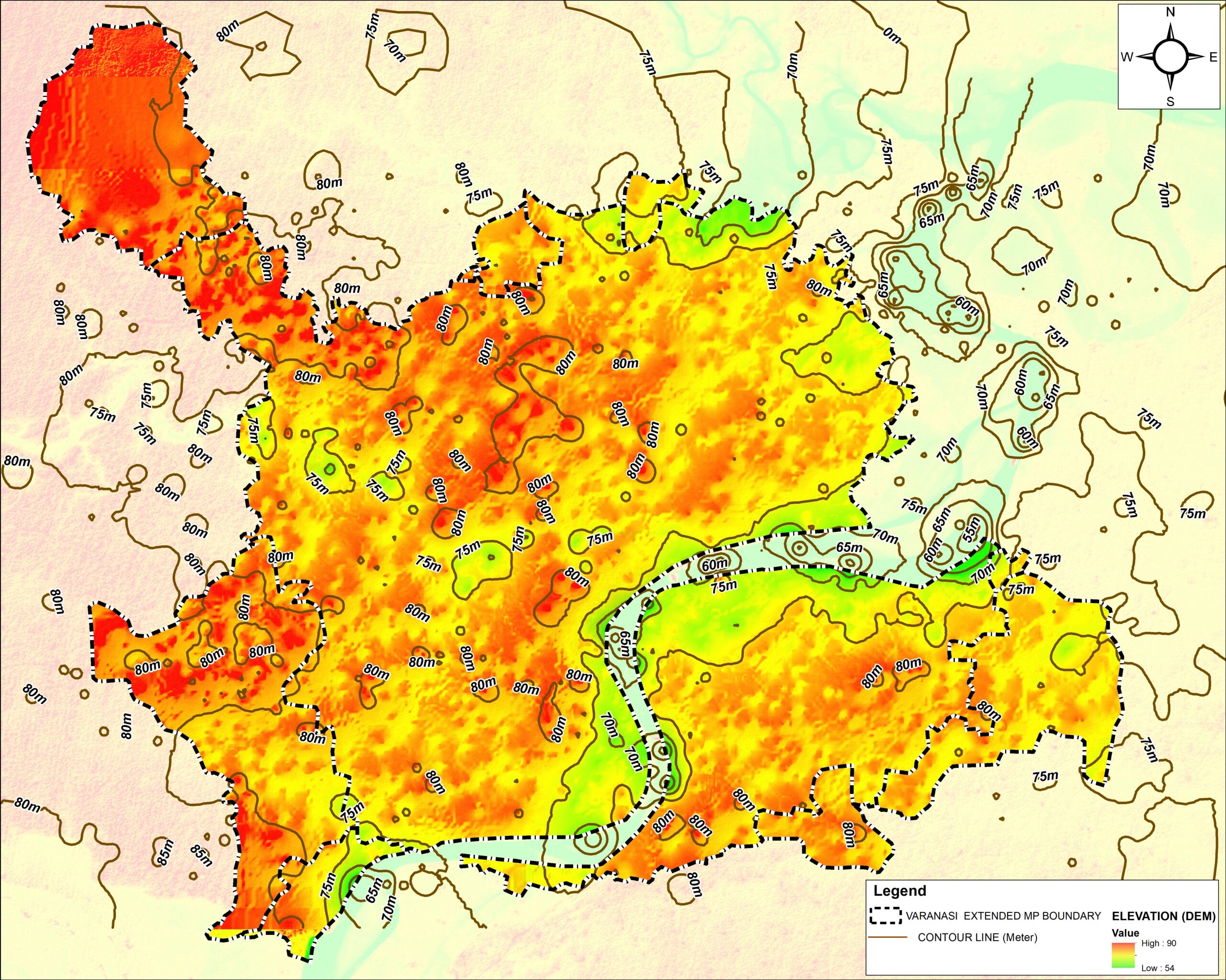
 SYSTRA India is proud to spearhead the digital and spatial transformation of Varanasi’s rapidly urbanizing landscape. Appointed as the primary consultant by the Varanasi Development Authority (VDA), we are deploying advanced Geographic Information Systems (GIS) and robust urban planning methodologies. Consequently, we are able to formulate a comprehensive structural blueprint. This strategic master plan directly supports the sustainable, regularized, and socio-economically vibrant expansion of Varanasi’s newly integrated territory. In this context, the GIS Master Plan Varanasi Development Authority is instrumental for future growth.
Key features of the project
The project is structured under the strict statutory framework of the Uttar Pradesh Urban Planning and Development Act, 1973. It leverages high-fidelity spatial data to balance rapid modernization with the preservation of Varanasi’s unique cultural heritage. Notably, the GIS Master Plan Varanasi Development Authority ensures statutory compliance throughout project implementation.
- Statutory Compliance & Framework: Formulating actionable development strategies and draft proposals in absolute alignment with the provisions of the Uttar Pradesh Urban Planning and Development Act, 1973. Clearly, the GIS Master Plan Varanasi Development Authority guides the creation of these proposals.
- Data-Driven Spatial Planning: Developing precise, high-resolution GIS base maps. These maps are integrated with sector-by-sector data analysis to establish a single, verified source of spatial truth.
- Predictive Demand Assessment: Conducting comprehensive evaluations of current civic pressure points. Alongside these, we produce long-term projections for housing, transit, commercial zoning, utilities, and green spaces.
- Issue Identification & Mitigation: Systematically locating environmental bottlenecking, infrastructure deficits, and zoning challenges within the newly extended boundaries. Because of this, we engineer preventative development strategies.
- Inclusive Stakeholder Governance: Integrating feedback from local communities, administrative bodies, and technical experts to build a transparent, consensus-driven development roadmap. Thus, the GIS Master Plan Varanasi Development Authority incorporates stakeholder interests into the urban vision.