 Australia
  Brazil
  Canada
  China
China  Denmark
  France
  Indonesia
  Ireland
  Italy
Italy  Malaysia
  New Zealand
  Norway
  Poland
  Saudi Arabia
  South Korea
  Sweden
  United Kingdom
  United States
  Singapore
  Taiwan
  Thailand
  Vietnam
 On 22 March 2023, the United Nations Water Conference opens in New York in an unprecedented state of emergency. This is only the second time that the international institution has organised a conference on this theme since the late 1970s. It is a critical time in many ways, and you don’t have to be an expert to see that: the ravages of climate change are putting increasing pressure on water resources. At this start of 2023, Europe is affected by a very worrying drought. In February 2023, France experienced its longest period without rainfall ever recorded1 for a winter, just a few months after a summer marked by drought episodes of unprecedented intensity. This is another major challenge for humanity, which is increasingly turning to a resource that is as poorly understood as it is essential: groundwater.
Water insecurity affects more than 2 billion people today according to the United Nations2. If our lifestyles remain unchanged, this could affect 6 billion people in the coming decades3. Moreover, human water consumption has increased by 600% over the last century, twice as fast as the population4.
Beyond human consumption, groundwater performs crucial ecosystem functions, supporting surface wetland habitats. These environments provide critical habitat for a wide range of plant and animal species. They also play an important role in maintaining water quality, filtering pollutants, and minimising the effects of artificialisation5, land reclamation and other human activities. They are also essential to climate change resilience, acting as natural sponges.
In the context of infrastructure projects, groundwater has often been considered by engineers as a geotechnical constraint to be taken into consideration in the design and construction of underground works. However, groundwater is first and foremost a vital resource to be protected. Therefore, the integration of the hydrogeological dimension is increasingly sought at the earliest stages of projects, in order to identify and quantify the risks to groundwater and to help ensure the long-term sustainability and resilience of projects.
1 Drought: 32 days without rain in France, a record | Météo-France
2 United Nations Organisation, 2021 edition of the United Nations World Water Development Report: UNESCO, Paris.
3 World Economic Forum
4 Water.org (https://fr.weforum.org)
5 Transformation of natural soil by urbanisation and infrastructure expansion, which can lead to its total or partial sealing
A scarce and dwindling resource
Why, on a planet 70% covered by water, do millions of people still have to live on less than 5 litres a day? While water as a substance is ubiquitous, water as a resource, an exploitable commodity, is much scarcer!
Of the total volume of water in the world, freshwater represents only about 2.5% and we can only use less than 0.4%. The rest is inaccessible to us, as it is either frozen or too deeply buried in the ground. Aquifers (groundwater reservoirs) store 97% of all the freshwater available in the world.
The irregular spatial or temporal distribution of water resources makes their access difficult and costly for many people. This problem of water availability has, moreover, been greatly aggravated by water pollution events, which have grown alarmingly in recent decades, particularly in large metropolitan areas.
Water scarcity is also amplified by two factors: economic models based on unbridled consumption of natural resources, and the growing impacts of climate change on the water cycle.
Indeed, population growth and the intensification of industrial and agricultural production means increasing demand and has led to an overexploitation of available natural resources, resulting in a decrease in freshwater reserves in many parts of the world. Overexploitation of groundwater beyond its natural recharge capacity has short-, medium- and long-term consequences on groundwater levels, promoting saltwater intrusion in coastal areas and soil subsidence6, which can affect buildings and infrastructure.
Water stress at the surface and increasingly intense droughts are taking a heavy toll on groundwater, which is being put under increasing pressure, even though its recharge capacity is being undermined by the same climatic phenomena.
6 Subsidence is a slow collapse of the surface of the earth’s crust
Climate change impacts on the water cycle and nature-based resilience solutions
The increasing demand for water resources and the environmental challenges arising from climate change require adaptability from all economic sectors. For engineering, this need is coupled with an obligation to find innovative solutions that allow our projects to be executed in a sustainable manner.
In this context, several factors intersect and feed into each other to amplify the chain effects of climate change on water resources and the water cycle:
- More intense and scarcer rainfall, and therefore less effective in recharging aquifers;
- Increased temperatures cause soils to dry out, endangering the water reserves available for plant life (root-zone soil moisture called green water) and increasing evaporation and runoff to the detriment of aquifer replenishment. The ‘green water’ is one of the planetary boundaries considered to have been crossed7;
- The increase in runoff rates is to the detriment of aquifer recharge, which favours the recurrence of floods and their catastrophic consequences. Three quarters of recent environmental disasters are water-related, representing some $700 billion in economic losses over the past 20 years.
Understanding the functioning and monitoring the status of groundwater systems is indispensable for the protection of aquatic environments (wetlands, springs, ponds, and other types of groundwater-fed surface water courses). The rehabilitation of these wetland environments is the cornerstone of climate resilience and the foundation for engineering nature-based solutions. By harnessing the storage – not only of water as they are also important carbon sinks – and purification power of natural processes and ecosystems. These solutions can help restore and protect vital components of the water cycle, thus preserving ecosystems and natural habitats.
In addition, these solutions are likely to generate a chain of positive impacts, such as reducing the risk of flooding and soil erosion, improving water quality, and preserving biodiversity.
7 Wang-Erlandsson, L., Tobian, A., van der Ent, R.J. et al. A planetary boundary for green water. Nat Rev Earth Environ 3, 380–392 (2022). https://doi.org/10.1038/s43017-022-00287-8
Constraint and resource
Groundwater is a well-known constraint in infrastructure projects, and not only for hydrogeologists. It is an essential risk to be taken into consideration from the pre-project phase. But this risk has two faces: the risk of groundwater on the construction site and final structure, and the risk that the construction site and final structure pose to the water resource in the long term.
The approach to groundwater as a constraint is fully part of the geotechnical risks. It is the subject of much attention because it can lead to soil liquefaction, be the cause of subsoil flooding, cause landslides, soil compaction in case of over-pumping or encourage regressive erosion phenomena, among others.
However, in a virtuous and sustainable approach to infrastructure operations, groundwater must at the same time be considered as a resource to be preserved. I insist on the temporality of this consideration which, to be effective, must be integrated as early as possible in projects. Underground works (excavations, insertion of buried structures, groundwater drainage, etc.) can impact groundwater temporarily or permanently in several ways:
- Through a barrier effect, by creating obstacles to their natural flow;
- By lowering the groundwater level, by active or passive dewatering, which can affect the direction and rates of groundwater flow and levels, and therefore their support function for surface ecosystems;
- By creating pathways for the infiltration of surface pollution into the deep aquifers.
The consideration of groundwater preservation is nowadays targeted by regulatory obligations arising from water legislation. The regulatory framework depends strongly on the country, but certain principles are immutable: an approach based on risk management and the precautionary principle, an assessment and proposal of impact mitigation measures throughout the project, strict regulatory compliance, the adoption of best practices, and, increasingly, an objective of restoring groundwater and the natural areas that depend on it. Especially in already urbanised areas, infrastructure projects thus become an opportunity to ‘repair’ the damage caused to ecosystems in the past. By implementing, from the design stage, good stormwater management, renaturation of green spaces and creation of ecological corridors, restoration/creation of ponds and wetlands by targeting areas with a natural tendency to groundwater flooding, etc. In several projects, the dimension of resource preservation and restoration of ecosystem services is already an integral part of the specifications, as the example of the High Speed 28 project in the UK has shown.
The most essential work of a hydrogeologist is to thoroughly characterise the groundwater resource, understanding its features and behaviour. Knowing this invisible element in order to take it into account is at the heart of his/her assignments. This objective echoes the one put forward by the United Nations in its recommendations for a better consideration of groundwater: know it and be able to preserve it9. Associated with the upstream stage of the projects, the hydrogeologist will be able to contribute to leading the operations in the direction of environmental resilience by working on the two components risks/resources and thus to secure the project and the natural environments.
By proposing conceptual and numerical models based on ad hoc data, the hydrogeologist makes the invisible visible and enables the behaviour of aquifers and their reaction over time to be anticipated for different scenarios. But in the context of infrastructure projects his/her missions are not limited to modelling: the hydrogeologist, in addition to working actively on gaining consents for the structures from regulators, proposes solutions for reducing the impact of operations and for the restoration of natural environments. They work in partnership with other professionals to help them design and restore aquatic ecosystems, including green and blue infrastructure10, ecological corridors, and wetlands.
8 HS2 High Speed Line – United Kingdom | Projects | Systra
9 2022 edition of the United Nations World Water Development Report: Groundwater: Making the invisible visible. UNESCO, Paris
10 The GBI (green and blue infrastructure) is an approach that aims to maintain and reconstitute a network of exchanges so that animal and plant species, like humans, can circulate, feed, reproduce, rest, etc., and thus ensure their life cycle. GBI aims to include the preservation of biodiversity in land-use planning decisions, contributing to the improvement of the living environment and the attractiveness of residential and tourist areas.
ExAmples OF HYDROGeOLOGICAL MODELLING IN 3D AND 2D
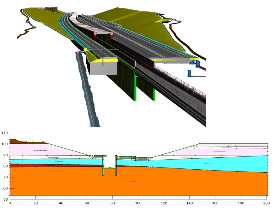
Within SYSTRA, this field of expertise is considered as early as possible in projects. Our dedicated team is involved in all aspects, from aquifer characterisation to groundwater modelling, right through to interactions with surface ecosystems, providing valuable technical support to design teams and assistance during consenting when projects are being examined by the regulatory authorities. At the crossroads of good risk management and sustainable site management, hydrogeology is an essential skill that adds value to our operations, to be used without moderation.
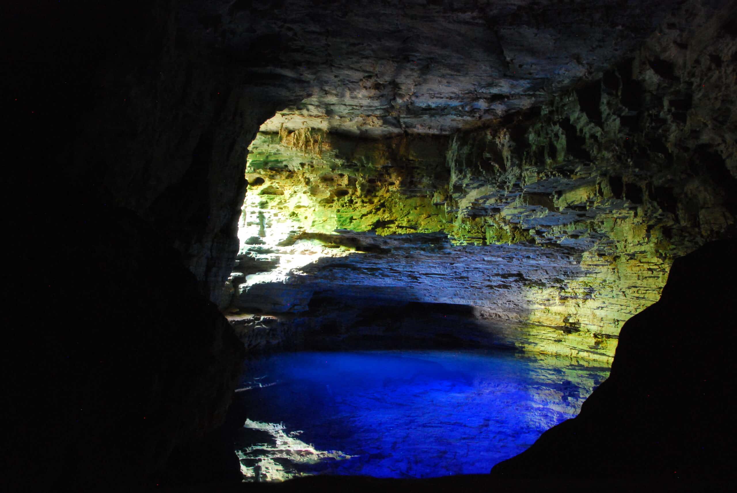
*Photo credit – Gruta do Lago Azul – Brazil: Frédéric Bizet