Organise and decarbonise your public transit network
With Transiplanner, create and test economically efficient and environmentally friendly network organisation scenarios.
As a player in urban or suburban mobility, authorities and passenger transport operators must now offer an optimised service in line with the stated objectives of greening their vehicle fleets.
With Transiplanner, implement a transport service:
- Serving efficiently trips generators
- With limited operating costs,
- Minimising the fleet size required according to the type of engine
- Minimising the environmental impact
by modifying the routes of the lines, the position of the stops, the frequencies of passage, and by diversifying the energy sources of the vehicles in service.
Control your operating costs, increase your revenues and plan the progressive greening of your vehicle fleet!
Features

CREATING THE DIGITAL REPLICA OF YOUR NETWORK
- Load the GTFS of the network on typical days as well as the socio-economic data of the territory (GIS files)
- Enter default unit values (costs, vehicle consumption and emission, speed, time at stops, ..)
BUILDING YOUR SCENARIOS
- Create scenarios in the scenario manager module from the existing network
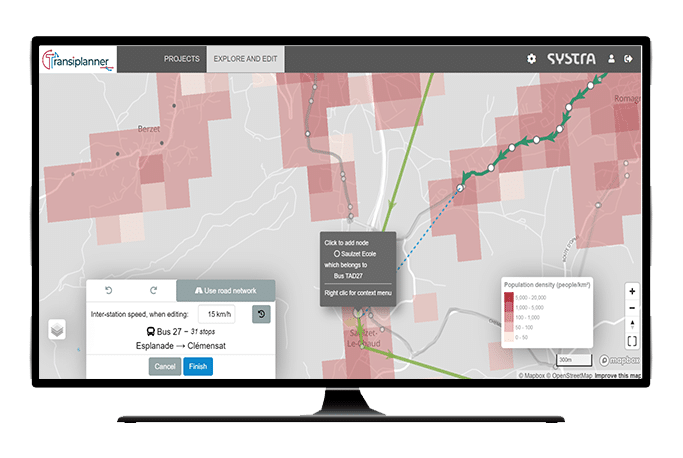
- Modify routes, headway, running times per line section, time at stops
- Create new transport lines with the help of an integrated route planner
- Add or remove stops
- Modify transport modes and their associated motorisation
- Modify operating costs, consumption and GHG emission rate per unit of work


CALCULATION OF YOUR OPERATING, ENERGY CONSUMPTION AND POLLUTANT EMISSION INDICATORS
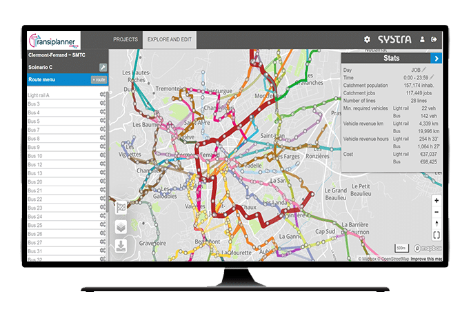
- Calculation of VehxKm and driving hours per line and per mode
- Calculation of operating costs per mode, line or service
- Calculation of energy consumption by type (H2, CNG, Electric, fossil,..)
- Calculation of the network’s GHG emissions
- Estimate of the fleet by mode, line
- Produce operating table by service
- Aggregation of indicators at the level of the entire transport network
ACCESSIBILITY AND TRIPS GENERATORS COVERAGE
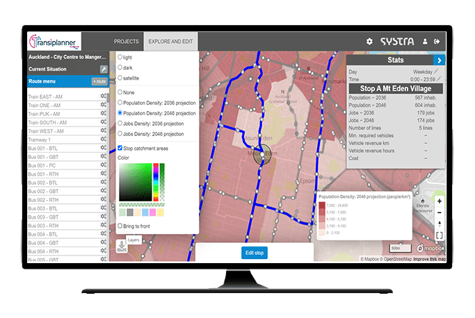
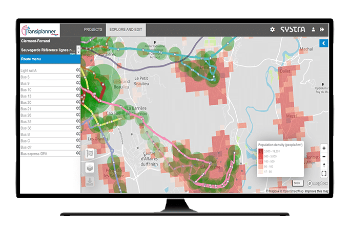
- Define a catchment area around your stations according to the performance of the transport modes
- Select your own traffic generators (Population, facilities, jobs location etc.)
- Calculate the quality of the service per station, line and and the spatial coverage of the network
- Visualise the stop-stop route and the associated journey time broken down by mode, travel duration, and transfer time

BENEFITS
- Transiplanner is a web solution accessible to all project stakeholders that enables collaborative work on transport planning and fleet greening process.
- Our solution integrates a web GIS that facilitates spatial and contextual understanding of your territory with georeferenced backgrounds (Google maps, OSM, aerial view, …)
- With a user-friendly interface, the platform can also be used in workshops to quickly define an attractive and shared transport network.
- The results can be exported in GTFS format, and used by demand forecasting tools (for example: QUETZAL) or graphic/cluttering tools to further your work.

WANT TO KNOW MORE? COME AND MEET US!

Hubert METGE
Business Developper
 Australia
  Brazil
  Canada
  China
China  Denmark
  France
  India
India  Indonesia
  Ireland
  Italy
Italy  Malaysia
  New Zealand
  Norway
  Poland
  Saudi Arabia
  Singapore
  South Korea
  Sweden
  Taiwan
  Thailand
  United Kingdom
  United States
  Vietnam